Friday, 9 November 2012

Day 4 - Siddons Fort

On April 18th 1918 Reverend V D Siddons flew along the Hejaz railway south of Ma'an and drew a sketch map from his tiny plane cockpit. This map showed three significant military features along a 25 km stretch of the railway.


Siddons joined the army three years before the outbreak of war. During this time he was training to be a Methodist minister. After serving with army regiments in France he transferred to the middle east and then became a member of the famous "C" Flight of 14 Sqn RFC in the Hejaz, where they and a few British troops were co-operating with the Arabs.  He was stationed in the Hejaz for two years, the last six months of which he commanded the RAF (as it had become) detachment in that area.  For his work he was awarded the DFC and was Mentioned in Despatches and also awarded the Order of Al Nahda by the King of the Hejaz.

Today we went to the third feature from that original map, sadly not available, that we have visited in our past few seasons here in Jordan. As a consequence of his efforts which led us here, we have named today's feature Siddon's Fort.


This consists of a rectangular walled enclosure of around 30 metres in length, containing two distinct circular features. To one side is a stone marked path leading from the railway, and near the end of this path just west of the main enclosure is a smaller, secondary feature. The aerial photograph, taken a couple of years ago from our helicopter trip through Jordan, shows the features clearly. It also shows the smaller feature intact, and sadly since that was taken it has been trashed, probably by a large vehicle driving straight through it.


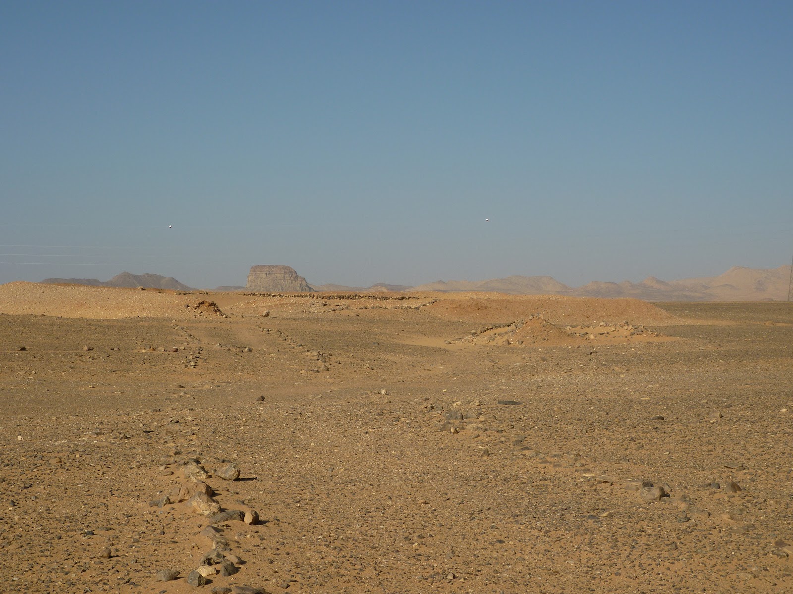


The team today began excavating and recording this site. The walls of the main structure and the interior features are banked with rubble and sand, and the whole enclosure contains many layers of windblown sand. The first job was to pick out bits of the site to investigate and then set about clearing.

In the meantime the detectorists swept the sit and revealed a small amount of both incoming (303 machine gun rounds) and outgoing (Mauser cartridges) fire. The small rough diagram shows the general pattern of these finds. 


It looks likely that a small exchange of fire occurred with x's marking the general location of incoming rounds and circled x's showing the return of fire. It's possible that one of the armoured vehicles used by Lawrence and associates in the Hejaz Armoured Car Company sped past this site travelling from the North East towards Tel el Shahm, machine guns blazing, to be met by hasty resistance from the stationed forces.

Also included in the images from today are pictures of the very long King's Highway we travel down each day in minibus and 4x4, and a typical desert lunch eaten by members of the group at some point during a long days work in the field.


Thursday, 8 November 2012

Day 3 - Wadi Rutm Fort

Back to the fort today for more work from this fantastic elevated position. Of all the GARP sites this one ranks as the one with the most beautiful and astonishing views of the geology of Southern Jordan. The fort sits at around 1170 metres above sea level, and about 500 metres above the valley floor below. The geology   is principally volcanic, with great igneous flows having been broken up over centuries by alternate heat and frost. 


Most of the sites we are working are characterised by this hard, sharp basalt of hugely varying size, either embedded in a solid sand top surface or mixed in with blown sand in ridges and on the sides of hills and promontories. Many of the features we are looking at have sand blown into them which has to be removed before the more delicate excavation can begin. Some surfaces are hard and the trowelling is difficult, but often finds are on or near the surface, which means they can be found 'eyes only', without the need for metal detecting or sieving of removed material. Some of the images today show this landscape and its surface to give readers an idea of the terrain and nature of the digging and investigation.


The work at the fort continued today with all members of the party going to the site initially and then a couple of teams departing to do some exploratory work at other sites. 


Wednesday, 7 November 2012

Day 2- delays and then the fort

Up at 6.00 am for breakfast then loaded up the bus and 4x4's with tools and provisions for the day. We set off at about 7.30 for the drive back to Wadi Rutm fort to continue the work. Shortly after passing through Ma'an we met a police road block which stopped us re-entering the Kings Highway to travel south to the site. We were informed there was 'some police action' further down the road, and the double road block here and 200 metres further down the road made it clear nothing was going that way for a while. 

As it happened we had stopped near the foot of the Hill of The Birds, the site of the first main activity on year's one and two of our digs in Jordan, and the subject of the photograph at the top of this page. You can clearly see to the right of that image, behind the smiling local boy, the sand filled remains of the trenches that were used to defend Ma'an station during one of the major battles in this region. It was here that we have previously found a large quantity of evidence of the military conflict surrounding Ma'an station, including incoming rounds, spent cartridges for outgoing fire, many uniform buttons and the like. 

As we were so near to the station we headed down there for a while to show the new members of the team this site and to wander among the newly refurbished buildings. It is intended that this becomes a main heritage site for the region and to that end several improvements have been made, including the construction of a car park and other amenities. (images to follow).

We were then informed the road was clear and so carried on down to Wadi Rutm fort.

Here the finds have mirrored those described above so far, although to a much smaller scale and with the total absence of uniform buttons. (Images to follow).

This presents a puzzle. Why do some sites have a very large incidence of lost military buttons and others have virtually none? Is it that the different forces involved with the sites had variant uniforms? Or better thread? Or simply picked up their lost buttons and sewed them on again? Or was the level and type of conflict different and that produced the large loss in one circumstance and not another? We continue to think and discuss this, with new ideas and theories from within the group being put forward all the time. Maybe you have a theory?

More pictures of the work and site from today: (Click for larger versions of the images, and a gallery view)


Also many of us wear a traditional Jordanin Keffiyeh when in the desert, for protection from the sun, sand and wind. Consequently new team members sometimes find themselves in a local shop purchasing said item. Here is Rob trying on his new scarf and showing how the shopkeeper told him to wear the tassle from the headband. 


More from the work at Wadi Rutm fort tomorrow.

Tuesday, 6 November 2012

Day 1 - Wadi Rutm Fort

In 2006 the very first GARP team investigated the ruined station at Wadi Rutm on the Hijaz railway. The following yer we went back to look at the camp site associated with defending this station.


This site is flanked to the east by a high flat-topped ridge which overlooks the station and has a fantastic panoramic view on three sides to the east, south and west. This plateau has been fortified with a surrounding low wall and internal workings and it is in this large mixed site that we are beginning our 2012  season of work here in Jordan.


Wadi Rutm fort makes excellent use of the elevated position, having commanding views to the valley below and beyond, making it ideal for observation and resistance to attack. On arrival today we briefly walked the site and then set about systematically working on the features present. Some of the features were allocated for analysis by clearing or digging trenches, and teams were set up to begin excavations of these.  The interior of the walls to the site, which stand around 50cm - 1m tall and are made of piled rocks, were scanned by the detectorists to see if there was any evidence of military conflict associated with WW1.


Preliminary results after day 1 show clearly that this was a site that had been defended against attack. The western wall of the complex has a ridge of wind blown sand against the rocks, and detectorists have unearthed significant finds of Mauser cartridge cases indicating Ottoman troops firing out from the site, together with incoming 303 rounds (bullets in various states of deformation) coming from the opposing forces. These together with shell fragments and lead balls from overhead exploding shells indicate this was clearly the site of at least one battle.


There is much to do here and we will be working on this site for a number of days, trying to unravel the main features of the site and further understand its importance in the context of the conflict.


Friday, 2 November 2012

Preamble - a typical MD finds photo


To wet the appetite for this season here is a picture of some metal detecting finds from one site in the middle of the southern Jordanian desert.

The picture shows variety of Ottoman army uniform buttons displaying the definitive crescent and star, some other buttons, a couple of coins and other bits typically lost and subsequently found at a military camp site.  Also at the bottom is a personal seal matrix which has lost it's holding stem, next to an intact personal seal.

To the left of the picture is the archaeologist's main weapon of choice - the WHS trowel. With its tough 4 inch forged carbon steel blade variants of this tool have been used on archaeological sites throughout the world, helping to unearth and preserve historically important artifacts everywhere. 

Tuesday, 30 October 2012

Edom Hotel location

Aerial view of our hotel, The Edom,  in Wadi Musa

Zoom out and look to the left a bit for the entrance to Petra - near the parked coaches. (On some browsers you will need to click on the View Larger Map link to do this)

Zoom out lots to see where we are in Jordan, the Middle East and the world.

Friday, 19 October 2012

2012 Season Preview

GARP Season 7 begins in a couple of weeks, with the main party arriving in Jordan late on November 4th.


Project Background for new readers


The Great Arab Revolt Project (GARP) is planned as a ten-year project to investigate First World War archaeology in Jordan and develop new heritage sites for visitors. In contrast to the Western Front, where considerable fieldwork has taken place, First World War remains in Jordan have never been systematically investigated. These remains have particular interest for four reasons:
  • they are associated with the exploits and legend of Lawrence of Arabia, an iconic historical and cultural figure in the English-speaking world
  • they represent a struggle that was central to the creation of the states and conflicts of the modern Middle East
  • they represent the archaeological imprint of a distinctive type of irregular or guerrilla warfare which has been of huge historical importance over the last 90 years
  • they offer a range of military landscapes, sites and artefact assemblages, and a range of memories, associations and modern significances, which contrast with the more familiar archaeology, commemoration and tourism of the Western Front
Our aim, working closely with Jordanian colleagues and local communities, is to catalogue the  visible remains (buildings and earthworks), to carry out surveys and trial excavations at a representative sample of sites, to record oral histories and folk memories, and to develop one or more sites for effective public presentation.


The 2012 fieldwork season

The areas we wish to study this season, if permissions are given, are as follows:

Wadi Rutm Fort and Mudawarra


Though plans can change due to circumstances, our current intention for the 2012 season is to focus our work on two main sites. We will return to Wadi Rutm in order to investigate the hilltop fort and associated complex which lies at the top of the ridge to the east of Wadi Rutm station. This location has commanding views to the west, south, and east, and was clearly central to effective control over the entire stretch of landscape from the Batn Al-Ghoul escarpment in the north to Tell Shahm in the sand desert to the south.

We will also investigate Mudawarra, an extensive complex comprising three large hilltop forts and a reused Early Ottoman fort and associated buildings. Mudawarra was (and is) a major oasis and agricultural settlement on the traditional Hajj routeway through the sand desert, and was heavily militarised during the Great Arab Revolt.  

You can follow our work this season by checking the blog each day. For automatic updates please become a regular follower by clicking on the  Join this site  button the right of this message. (You don't need a Google account to do this). Also please share our progress by tweeting or posting to your Facebook timeline - we love getting new people interested in our project. You can use the links on the right to visit the main GARP website or travel back through previous exciting discoveries recounted in the blogs of earlier seasons.